


This is part of Castle Rock Lifestyle Guide → [Castle Rock Lifestyle Hub] & Castle Rock Real Estate Guide → [Castle Rock Real Estate Guide]
Written by: Chad Cabalka
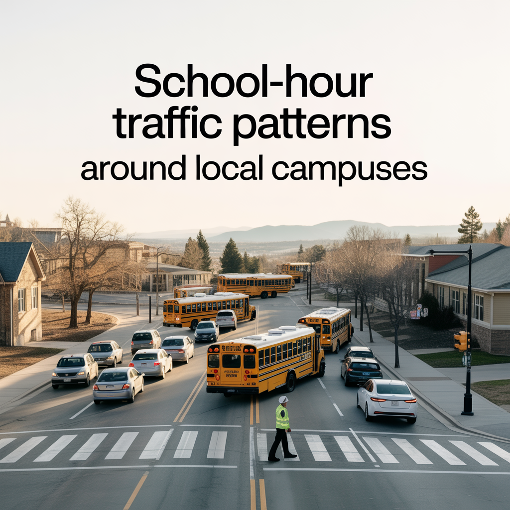
Around Castle Rock schools, “traffic patterns” really means “short, predictable waves that hit hard twice a day in very specific places.” If you understand those windows and chokepoints, you can plan your routines so school traffic is something you work with, not fight against.
When the Waves Actually Hit
Most Castle Rock campuses follow a similar rhythm: a tight arrival window in the morning and an even tighter departure window in the afternoon. Exact times vary by school, but the pattern is consistent:
- Morning: roughly 20–30 minutes before the first bell until 5–10 minutes after.
- Afternoon: from about 10 minutes before dismissal to 20–25 minutes after the bell.
During those windows you see:
- Backed‑up left turns into and out of school entrances.
- Short but intense queues along the primary approach streets.
- Slower travel on nearby collector roads as drivers anticipate crossing guards, buses, and kids on foot or bikes.
Outside those bands, many of these same streets feel like any other neighborhood road.
What It Feels Like Around Different School Types
High schools produce the heaviest and most complex traffic. The town notes that the school zone by Douglas County High School, for example, extends farther than most because of specific safety needs and higher volumes of both vehicles and pedestrians in that area. That combination of teen drivers, buses, parents, and kids walking or biking explains why high‑school zones tend to have longer reduced‑speed stretches and more visible enforcement.
Elementary and middle schools typically generate:
- Shorter but still intense car lines.
- Clumps of kids walking or biking on the same routes every day.
- Heavier crossing‑guard activity at a few key intersections instead of a larger surrounding zone.
Afternoons can be more chaotic than mornings because younger siblings, after‑school programs, and older kids leaving at slightly different times all overlap.
School Zones, Enforcement, and Safety Focus
Both the Town and Douglas County take school‑zone behavior seriously:
- The Douglas County Sheriff’s Office traffic unit regularly focuses on school‑zone enforcement and works with the district to address drivers who ignore bus warnings and school‑zone rules.
- Castle Rock’s transportation FAQs call out the use of flashing beacon crosswalks to improve driver yield rates, noting that when beacons are used correctly, drivers yield over 90% of the time versus about 50% without them.
The message is clear: around schools, you’re expected to slow down and be ready to stop. If you live or drive near a campus, you’ll see speed traps, crosswalk upgrades, and periodic enforcement blitzes, especially at the beginning of each school year and after complaints.
How Road Design and Growth Feed School-Hour Traffic
Castle Rock’s own transportation FAQs acknowledge that moving across town can be slow, especially during busy periods, and that east‑west and north‑south arteries are still being upgraded to keep pace with growth. Parents feel that at school time:
- Routes like Meadows Parkway, Founders Parkway, and streets feeding Douglas County High, Castle View, and nearby elementaries become mini‑arterials for school traffic and town‑wide commuters at the same time.
- Growth areas—like those feeding into Mesa Middle and Douglas County High from new developments such as Macanta—add more students to existing corridors, which is one reason DCSD’s boundary and capacity analysis now explicitly considers travel time and transportation efficiency when proposing changes.
The district’s boundary study for Macanta, for example, notes that reassigning students from Parker‑region schools to Castle Rock schools would shorten average bus ride times by 15–20 minutes and consolidate routes. Less time on buses and fewer overlapping routes around campuses translates directly into less congestion in those school zones.
Common “Pinch Points” Around Campuses
Most Castle Rock school‑hour congestion clusters around a few predictable features:
- Single main entrances off busy collectors, creating turn‑lane queues that block through traffic.
- Crosswalks directly adjacent to campus, where crossing‑guard activity stops traffic in short bursts as kids cross.
- Short stacking space in front of schools, forcing car lines to extend onto public streets.
You feel this most:
- Along Wilcox and adjacent streets near Douglas County High and downtown schools, where town traffic and school traffic overlap.
- On the main corridors feeding The Meadows, Terrain, and Founders, where one or two key roads serve multiple schools and surrounding neighborhoods at the same time.
Town‑level efforts like signal‑timing improvements, adaptive signal projects, and planned widening of certain corridors (for example, the upcoming Fifth Street work) are partly about smoothing these school‑hour movements so everything doesn’t gridlock at once.
Practical Strategies Residents Use
Once you know where and when the waves hit, you see three broad strategies that Castle Rock residents adopt:
- Timing shifts
- Leaving the house 10–15 minutes earlier or later than the main arrival window.
- Planning non‑school errands (gym, coffee, groceries) just outside the worst 30‑minute block.
- Route selection
- Using alternate neighborhood streets rather than the main school frontage whenever possible.
- Approaching from the “back side” of a campus when there are multiple access points to avoid primary turn queues.
- Mode changes
- Encouraging walking or biking from close‑in neighborhoods when safe routes exist, which reduces car volume directly in front of schools.
- Using bus service where available to cut down on individual drop‑off trips, something the district’s transportation team considers when consolidating or adjusting routes in growth areas.
Families that plan around these patterns generally describe school traffic as “short but manageable.” Those who try to push through the heart of the wave every day—especially across town near multiple campuses—feel more of the frustration the Town acknowledges in its transportation FAQ.
If you tell me which specific Castle Rock schools or corridors you’re centering in your piece (Douglas County vs Castle View side, Meadows vs Founders, etc.), I can help you translate these general patterns into more concrete, neighborhood‑level descriptions of how school‑hour traffic actually feels on those streets.
Get the full Denver Market Insights → [Market Insights]


Aurora Southlands Living For Aerospace And Defense Families
This is part of Lockheed Martin Relocation → [Lockheed Martin Relocation Hub] & the larger Denver Relocation Hub → [Denver Relocation Hub] Written by: Chad Cabalka Relocating to Denver for Lockheed Martin changes the home search fast, because Waterton Canyon is not the kind of campus you casually “figure out later.” The southwest metro drives the whole…
Best Neighborhoods For Buckley Space Force Base Commuters
This is part of Lockheed Martin Relocation → [Lockheed Martin Relocation Hub] & the larger Denver Relocation Hub → [Denver Relocation Hub] Written by: Chad Cabalka If Buckley Space Force Base is the anchor of your move, the best neighborhoods are usually in east and southeast Aurora, with the strongest practical options around Southlands, Murphy Creek, East…
C-470 Commuting Strategy For South Denver Aerospace Workers
This is part of Lockheed Martin Relocation → [Lockheed Martin Relocation Hub] & the larger Denver Relocation Hub → [Denver Relocation Hub] Written by: Chad Cabalka If you work at Waterton, split time between Waterton and the DTC, or live anywhere in the south metro with a Lockheed Martin paycheck attached to it, C-470 is the corridor…