



Phoenix Lifestyle Guide → [Phoenix Lifestyle Guide] & For more info on Phoenix Real Estate → [Phoenix Real Estate Guide]
Written by: Renee Burke
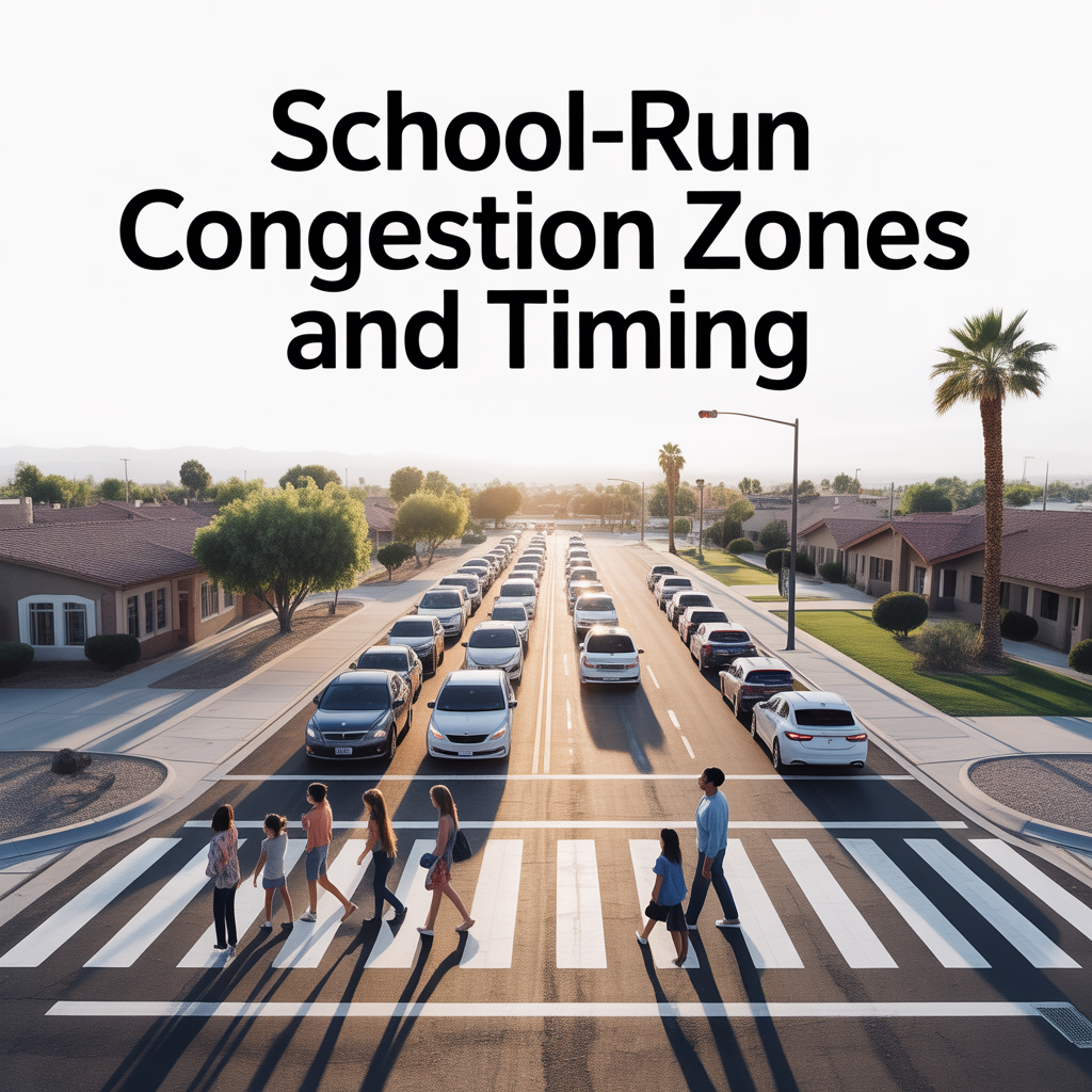
School-day traffic in Phoenix has a rhythm all its own—one that wraps around school bells, bus routes, and family drop-offs, turning familiar streets into temporary puzzles if you’re not prepared. For families settling here, understanding these patterns means smoother mornings, less stress, and more time for what matters after the bell rings.
The School-Day Traffic Pulse
Phoenix school days typically run 7:30-8:30 a.m. for drop-offs and 2:30-3:45 p.m. for pickups, layering extra volume onto our standard rush hours. Buses, parent carpools, and crossing guards create pinch points near campuses, especially in family-heavy suburbs where multiple schools feed the same arterials. It’s not gridlock like bigger metros, but it reshapes timing—adding 10-20 minutes to nearby commutes on a Tuesday versus a Sunday.
What I share with clients is how this ebbs and flows by area: North and East Valley see the tightest clusters due to larger districts, while central zones blend school runs with urban flows.
North Phoenix: Deer Valley and Peoria Pressures
North Phoenix, with its Deer Valley Unified and Peoria Unified schools, turns arterials like Bell Road and Union Hills Drive into morning funnels. From 7:15-8:15 a.m., traffic thickens near campuses like Barry Goldwater High or West-Mec campuses, as families from Fireside or Sweetwater converge. Pickup at 2:45 p.m. reverses it southbound on I-17 ramps and Loop 101.
Anthem edges quieter with staggered starts, but Norterra sees bus queues spilling onto Tatum Boulevard. Homes here shine for parents who time work around this—leaving 15 minutes early dodges 90% of the bustle.
Central and South: Encanto and Alhambra Flows
Central areas like Encanto and Alhambra blend Phoenix Union High and elementary pickups onto 7th Avenue, 19th Avenue, and Indian School Road. Mornings peak 7:30-8:15 near Steele Elementary or Central High, with buses stacking at lights. Afternoons hit Camelback Road hard around 3 p.m., as kids head to after-school sports or home.
South near South Mountain High adds Baseline Road backups, but Ahwatukee’s Kyrene schools stay contained thanks to dedicated turn lanes and timing lights. Parents love the predictability—apps like AZ511 flag school-zone cameras now rotating citywide.
East Valley: Mesa and Chandler Clusters
East Valley hums loudest: Mesa Public Schools flood Southern Avenue, McDowell Road, and Crismon Road during drop-off, especially near Mountain View High or Skyline. Gilbert’s Higley district tightens Val Vista and Elliot Road at 7:45 a.m., with pickups snarling Loop 202 on-ramps by 3:15 p.m.
Chandler’s Knox and Basha campuses draw Alma School Road caravans, but planned roundabouts ease flows better than central stoplights. Suburbs like Power Ranch time lights for buses, keeping delays under 10 minutes for locals who know the sequence.
West Valley: Peoria to Buckeye Spread
West schools spread wider—Peoria Unified along Olive Avenue and Northern Parkway sees 7:30 a.m. swells near Liberty High, thinning by Loop 101. Glendale’s Washington Elementary adds 59th Avenue morning density, while Buckeye Union keeps Watson’s area calm with rural spacing.
Vistancia shines with internal loops avoiding arterials altogether. Pickup waves hit 3-3:45 p.m., but open spaces mean quicker dispersal than denser east zones.
Freeway Impacts and Bus Patterns
School traffic ripples onto freeways: I-17 northbound crawls 7:45-8:15 from Peoria schools; US-60 eastbound stacks from Tempe pickups. Loop 101 in Scottsdale carries Paradise Valley buses smoothly, but Loop 202 Santan clogs near Chandler highs.
Valley Metro school buses follow fixed routes—check their app for overlaps with your street. Open enrollment spreads kids beyond neighborhoods, easing some hotspots but complicating carpools.
Safety Measures Shaping the Flow
Phoenix now deploys speed cameras in school zones (15 mph limits, rotating weekly) and high-crash corridors like Thunderbird Road or Baseline, cutting violations 30% already. Vision Zero adds buffered crosswalks near campuses, while four-way stops at smaller schools prevent backups.
Staggered bells—some at 7:25, others 8:05—spread loads smartly in growing districts. Monsoon-season slowdowns add caution, but clearer winter mornings flow best.
Choosing Homes Around School Traffic
Proximity saves time but invites chaos—aim for 1-2 miles out, where quiet streets feed campuses without immersion. North foothill homes offer trail escapes post-drop-off; East Valley master-plans integrate bus stops seamlessly.
Energy costs rise near idling hotspots, but resale favors walkable-to-school spots. Families thrive matching work shifts to this pulse—remote Tuesdays offset Wednesday carpools.
Navigating It With Grace
Ease into school-day life with:
- Precaching routes via Waze at actual bell times, three days running.
- Joining PTA texts for field-trip days spiking traffic.
- Parking blocks away, walking last legs—faster than circling lots.
- Aligning home searches to post-8:15 work starts or pre-3 p.m. endings.
These habits turn friction into flow.
A Warm Invitation
If you’re thinking about making a move in Phoenix, you don’t have to figure it out alone. Whether mapping school runs from a North Phoenix gem or East Valley easy-access spot, I’m here to guide you through patterns that fit your family’s real rhythm.
Reach out anytime—I’d love to trace routes together and find the home where mornings feel smooth and sure.
Get the full Phoenix Market Insights → [Market Insights]


-

Separating Lifestyle Spending From Homeownership Costs
-
How Usage Changes Monthly Ownership Costs
-

Planning Around Utility Cost Volatility
-
Why Variable Expenses Drive Most Budget Stress
-

Fixed Costs That Aren’t Actually Fixed
-

Budgeting for the House You’ll Own in Five Years
-

Why Ownership Cash Flow Feels Tighter Over Time
-
How Escrow Masks Long-Term Cost Growth
-

Why Your Mortgage Payment Isn’t Your True Housing Cost
-

Cross-Valley Trips: When They Feel Easy vs Heavy
-

Remote-Work Friendly Pockets in Glendale
-
School-Run Congestion Zones and Timing
-

Arterial Routing and “Daily Loop” Efficiency
-

State Farm Stadium and it’s Effect on Life and Property Value
-

Freeway Access as a Lifestyle Multiplier in Glendale
-

Event-Night Traffic Impacts and Avoidance Strategies
-
Weekday Commute Direction Tradeoffs From Glendale
-
Season Shifts in Outdoor Time in Glendale
-

Shade, Tree Cover, and Neighborhood Comfort
-

Dog and Kid Friendly Outdoor Routines
-

Trail Access That Feels Routine-Friendly
-

Sports Parks and Family Recreation Patterns
-
Map Proximity vs Summer Usability in Glendale
-

Daily-Use Parks vs Weekend Outdoor Trips
-

Top 10 “Date Night Out” Spots in Glendale