


This is part of Castle Rock Lifestyle Guide → [Castle Rock Lifestyle Hub] & Castle Rock Real Estate Guide → [Castle Rock Real Estate Guide]
Written by: Chad Cabalka
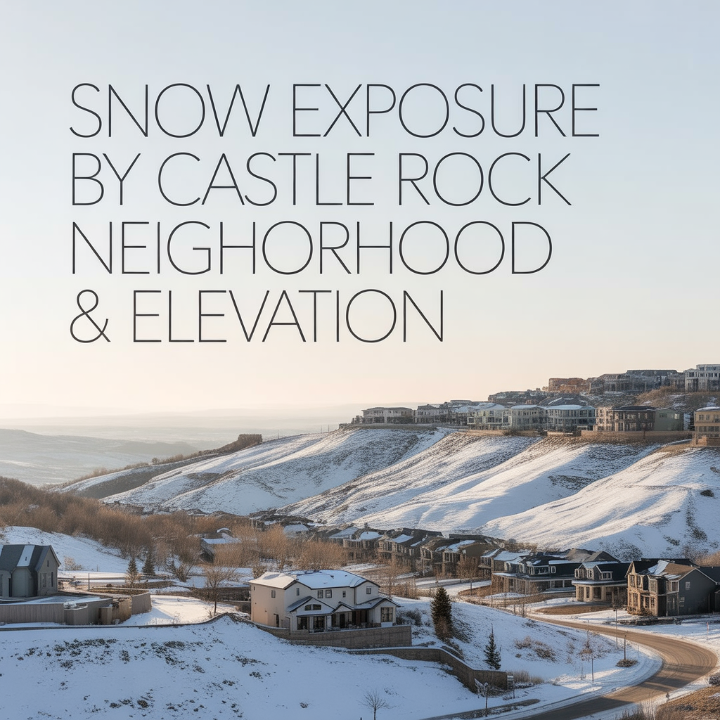
Castle Rock’s snowfall feels different neighborhood to neighborhood because of three things stacked together: elevation band, slope/aspect, and how exposed or tucked‑in a spot is. The town as a whole runs from about 5,850 feet in the creek bottoms up to just under 6,950 feet on the higher ridges, with an average around 6,400 feet, so you’ve got roughly 1,000 feet of vertical to work with across the area.
Big-picture elevation bands
Think of the town in three rough tiers, not exact lines:
- Lower band (around 5,850–6,200 feet):
Creek corridors and some older in‑town areas closer to East Plum Creek sit in this range. Snow can settle a bit more in cold inversions, but these pockets also get slightly warmer daytime highs, so lighter storms may melt off faster. - Middle band (roughly 6,200–6,500 feet):
This is where a lot of “core” Castle Rock neighborhoods land. The official town elevation is about 6,224 feet, and the average elevation of the wider Castle Rock area is reported around 6,404 feet. In this middle band you feel the classic Palmer Divide behavior: decent totals in upslope storms, but big day‑to‑day swings in melt depending on sun exposure. - Upper band (around 6,500–6,950 feet):
Ridgelines and higher benches, including some open‑space edges and hilltop neighborhoods, reach up toward 6,942 feet. These spots often see slightly more accumulation in marginal events (a degree or two colder, more wind‑driven drifting) and hold onto cold longer at night, especially when storms clear out.
That 500–800‑foot difference between one side of town and the other is enough to turn a “mostly slush” event in the lower band into a true shovel‑morning up high.
Slope and exposure: which side hangs onto snow
Elevation sets the baseline, but slope and aspect decide how your yard, driveway, and local streets actually behave after a storm:
- South‑facing slopes and lots
Get the most winter sun. Snow and ice melt faster on driveways, sidewalks, and roofs, especially on clear days after a storm. These are the places where you’ll see dry pavement and patchy lawns while shaded neighbors are still icy. - North‑facing slopes and lots
Stay colder and hold snow longer. Side yards, sidewalks, and shaded decks on the north side of a house can keep packed snow and slick spots for days or weeks, especially in higher‑elevation or canyon‑like pockets. - East vs west
East‑facing slopes warm early but lose sun earlier in the afternoon, so they often do fine through midday and then firm up again by evening. West‑facing slopes can be icy in the morning, then slush in the afternoon; in higher, wind‑exposed spots, that slush can refreeze quickly after sunset.
Layer that on the elevation bands and you get real‑world patterns like:
- A mid‑elevation, south‑facing cul‑de‑sac that’s walkable in regular shoes the afternoon after a storm.
- A slightly higher, north‑facing street a few blocks away where driveways stay slick and side streets stay hard‑packed for several more days.
Wind and drifting on ridges vs shelter in draws
Wind exposure is the third big variable, and it’s tightly tied to elevation and topography:
- Ridges and open exposures
Higher, more exposed neighborhoods and edges near ridgelines see more blowing snow and drifting. That can mean:- Bare spots where wind scours the pavement or turf.
- Deeper drifts in leeward corners, side yards, and along fences.
On storm days with strong north or northwest winds, plowed ridgeline streets can re‑coat quickly from drifting, and shoveling becomes more about moving drifted snow than uniform accumulation.
- Low draws and creek corridors
In more sheltered pockets near Plum Creek or other drainages, snow tends to fall and sit more evenly. Wind is less of a factor; temperature inversions and shade matter more. In some cold, still patterns, these areas can actually stay snow‑covered longer even if they’re technically a bit lower.
That’s why you can drive from a wind‑swept ridge (patchy snow, big drifts) down into town and find softer, more uniform coverage in a matter of minutes.
How this plays out by neighborhood “type”
Without mapping every subdivision, you can give readers a clear mental model by grouping Castle Rock areas by terrain rather than by strict lines:
- Ridge‑adjacent west side (e.g., higher parts near Ridgeline and western open space)
- Slightly higher elevations and more wind.
- More drifting and re‑freeze risk on exposed streets and driveways.
- Faster melt on south‑ and west‑facing homes; lingering hard‑pack on shaded side streets.
- Creek‑ and gulch‑adjacent pockets (closer to East Plum Creek, Sellars Gulch, and other draws)
- Slightly lower elevation, more shelter from wind.
- Snow falls and sits more evenly; sidewalks and paths can stay snow‑covered longer in shaded areas.
- Cold, still nights can hold frost and ice even when ridges feel drier.
- Mid‑slope, interior neighborhoods (away from both high ridges and deep draws)
- “Average Castle Rock” behavior: strong response to sun angle, with big differences between north and south sides of the same street.
- Plowed collector roads usually clear well; local side streets vary more by shade, traffic, and HOA/owner diligence.
If you describe it this way, readers can look at a map and say: “My target area sits on a ridge vs in a draw vs on a middle bench — so here’s how snow will probably behave at my house and on my daily routes.”
Practical implications for daily life
For homeowners and buyers, the snow‑exposure story really boils down to a few lived‑experience questions:
- How quickly do you want your driveway and sidewalk to dry out after a typical storm?
South‑facing and mid‑elevation spots usually win here; high, north‑facing slopes are the most work. - How much wind and drifting are you comfortable with?
Ridges get the views and fast‑drying roads in sun but pay for it with blowing snow and more refreeze cycles. Sheltered pockets are calmer but can feel more closed‑in and hold cold longer. - How do your commute routes run relative to these bands?
If your daily drive climbs up or down through multiple elevation/ exposure zones, you may want to assume more variability and give yourself more margin on storm days.
If you tell me which specific neighborhoods you’re planning to feature (e.g., The Meadows vs Terrain vs Crystal Valley vs in‑town), I can help you turn this into neighborhood‑by‑neighborhood “this is what snow actually feels like in January at your front door and on your local streets” language.
Get the full Denver Market Insights → [Market Insights]


Aurora Southlands Living For Aerospace And Defense Families
This is part of Lockheed Martin Relocation → [Lockheed Martin Relocation Hub] & the larger Denver Relocation Hub → [Denver Relocation Hub] Written by: Chad Cabalka Relocating to Denver for Lockheed Martin changes the home search fast, because Waterton Canyon is not the kind of campus you casually “figure out later.” The southwest metro drives the whole…

Best Neighborhoods For Buckley Space Force Base Commuters
This is part of Lockheed Martin Relocation → [Lockheed Martin Relocation Hub] & the larger Denver Relocation Hub → [Denver Relocation Hub] Written by: Chad Cabalka If Buckley Space Force Base is the anchor of your move, the best neighborhoods are usually in east and southeast Aurora, with the strongest practical options around Southlands, Murphy Creek, East…

C-470 Commuting Strategy For South Denver Aerospace Workers
This is part of Lockheed Martin Relocation → [Lockheed Martin Relocation Hub] & the larger Denver Relocation Hub → [Denver Relocation Hub] Written by: Chad Cabalka If you work at Waterton, split time between Waterton and the DTC, or live anywhere in the south metro with a Lockheed Martin paycheck attached to it, C-470 is the corridor…