


Glendale Lifestyle Guide → [Glendale Lifestyle Guide] & Glendale Real Estate Guide→ [Glendale Real Estate Guide]
Written by: Renee Burke
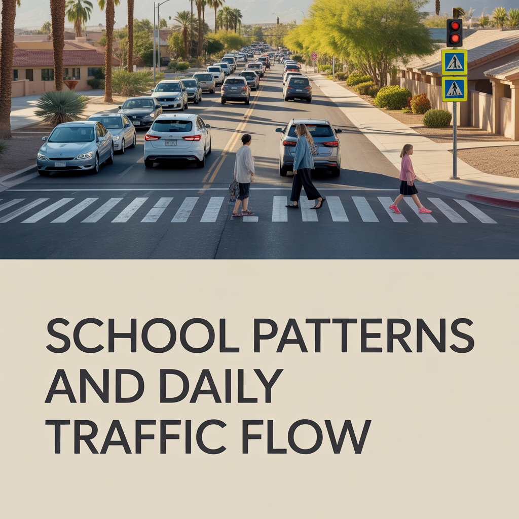
School schedules shape Glendale’s rhythm more than most people realize. Once you understand where the schools sit and how their start/end times work, the daily traffic pattern suddenly makes a lot more sense.
How School Zones Change Traffic
In Arizona, school zones follow strict rules: speed is typically reduced to 15 mph during designated hours or when the school-zone flashers are on, passing is prohibited, and drivers must stop and wait until crosswalks are completely clear of pedestrians. That slowdown compresses traffic into short, intense windows around drop‑off and pick‑up.
For Glendale drivers, that means:
- Arterials with schools on them move much more slowly at bell times, even if they’re usually high‑capacity corridors.
- Through‑traffic often diverts onto nearby residential streets to avoid congestion, which can shift volume into quieter pockets when parents are running late.
- Intersections near schools see more delays as crossing guards, turning cars, and buses cycle through the same limited space.
Glendale PD and the city use flasher programs and radar feedback signs on some arterial‑fronting schools to calm speeds and make these zones more predictable and visible to drivers.
Drop‑Off, Pick‑Up, and Neighborhood Flow
School-site design has a big impact on how “choppy” traffic feels nearby. Planning guidelines in Arizona encourage:
- Locating elementary and middle schools on internal collector streets instead of major arterials, to reduce the need for young kids to cross big roads.
- Providing on‑site queuing and clearly marked loading zones so parents aren’t stacking up in through lanes or blocking driveways.
Where that ideal isn’t fully met, you see:
- Long lines of cars spilling out of school driveways onto adjacent streets at bell times.
- Parents improvising drop‑off spots, sometimes stopping in no‑parking areas or near crosswalks, which tightens the road and reduces visibility.
- Short but intense periods where local residents struggle to get in and out of their own neighborhoods.
Over time, families living near schools adjust their routines—leaving 10–15 minutes earlier, timing grocery runs away from bell times, or using side‑street routes to avoid the primary school frontage.
Safe Routes and Walking/Biking Patterns
Glendale participates in Safe Routes to School efforts, working with campuses to map recommended walking and biking paths and educate students on safe travel. Those routes concentrate pedestrian and bike traffic onto specific streets and crossings.
That creates a predictable pedestrian pattern:
- Certain intersections become key student crossings, with more kids on foot and bike in the 20–30 minutes before and after the bell.
- Drivers who learn these patterns often avoid cutting through those streets at those times, both to save time and to reduce risk.
The city and partners use education programs, crossing‑guard support, and events like Walk & Bike to School Day to reinforce awareness for both kids and drivers.
Bus Activity and Midday Impacts
School buses add another layer: Arizona law requires drivers to stop in both directions for buses with flashing red lights and extended stop arms, remaining stopped until the bus moves or the driver signals it’s safe to proceed. Around Glendale schools, that means:
- Short, complete stops in the travel lane as buses load and unload, especially on two‑lane streets.
- Occasional midday slowdowns for field trips, special programs, or half‑day schedules.
- Drivers needing to stay alert even outside the traditional bell windows, particularly in neighborhoods with multiple campuses.
Parking restrictions near school entrances and crosswalks are designed to keep sightlines clear so small children aren’t hidden behind parked cars.
What This Means for Daily Life and Housing Decisions
When you layer all of this together, school patterns in Glendale create very predictable “pulse points” in the network. For someone choosing a home or planning their routine, it’s worth asking:
- Will my daily commute intersect an active school zone during bell times?
- Am I comfortable living on, or just off, a collector that serves as a primary route to a nearby school?
- Do I like the idea of kids walking and biking through my neighborhood, even if that means slower traffic twice a day?
Homes near schools can feel vibrant and community‑oriented, but you need to be honest about your tolerance for those short, daily surges in cars, buses, and pedestrians.
A Warm Invitation
If you’re trying to picture how Glendale’s school patterns will actually affect your mornings and afternoons, you don’t have to piece that together on your own from maps and bell schedules. Walking these areas at real bell times, understanding which streets carry most of the school traffic and which stay quieter, can change how you see a neighborhood.
I’m here to help you connect those dots—between school locations, traffic flow, and the way your day will really feel once you move in—so your choice is both informed and comfortable.
If you’re thinking about making a move in Phoenix, you don’t have to figure it out alone.
Get the full Phoenix Market Insights → [Market Insights]

-

Real Outdoor Access by Chandler Area
-
Commute Corridors and Directions in Chandler
-

School District Lines in Chandler