


This is part of Castle Rock Lifestyle Guide → [Castle Rock Lifestyle Hub] & Castle Rock Real Estate Guide → [Castle Rock Real Estate Guide]
Written by: Chad Cabalka
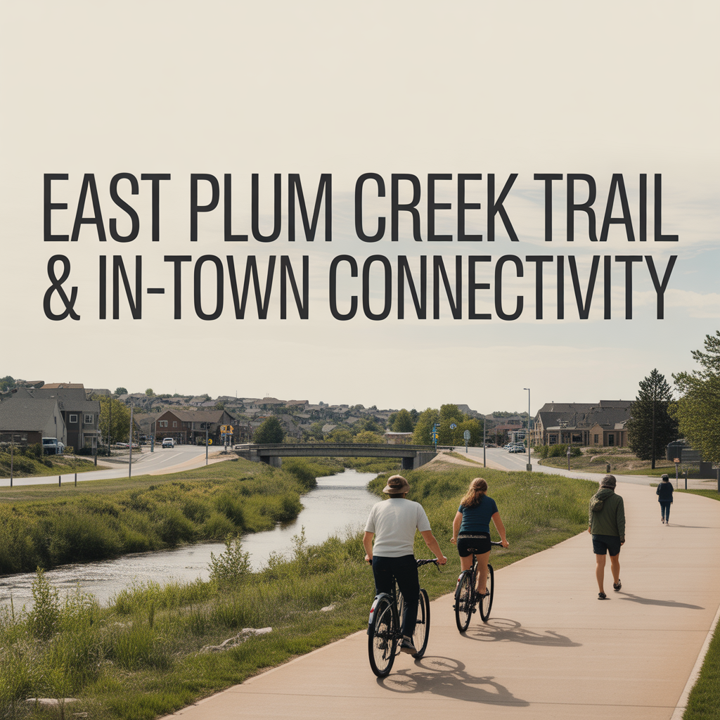
East Plum Creek Trail is the quiet backbone of Castle Rock’s in‑town connectivity. It’s not just a “nice walk by the creek” — it’s a paved spine that ties together neighborhoods, schools, downtown, and parks in a way you really feel once you live here.
What East Plum Creek Trail Actually Is
East Plum Creek Trail is a 10‑foot‑wide, paved multi‑use path that runs roughly north–south through the heart of Castle Rock, following East Plum Creek and lower Sellars Gulch.
Key basics:
- Length: about 8.6 miles end‑to‑end, depending on how you measure your out‑and‑back or connector segments.
- Surface: fully paved, rated “easy,” and open to walkers, runners, cyclists, strollers, and leashed dogs.
- Elevation: gentle grades with small ups and downs, so it’s doable for a wide range of ages and fitness levels.
On the ground, it feels like a green corridor: cottonwoods, willows, creek‑side habitat, and periodic open views toward The Rock and Pikes Peak. You’re often close to development, but the tree cover and riparian corridor give it a surprisingly natural feel.
How It Connects Neighborhoods and Key Destinations
One of the reasons locals love East Plum Creek Trail is how many places you can reach without getting in the car.
The trail currently runs between the area near Castle View High School on the north end and the Montaine/Crystal Valley area to the south. Along the way, it connects or passes close to:
- The Meadows and north‑side trailheads (parking off Meadows Parkway).
- Downtown Castle Rock, including Festival Park and the streets around Perry and Wilcox.
- Established neighborhoods near Plum Creek Parkway and South Plum Creek Boulevard.
- Southern communities like Crystal Valley and Montaine via the newer southern extension.
There are multiple access points and crossings, including trail entrances and crossings at Sabercat Way, Kinner Street, Wilcox Street, Perry Street, Fair Street, Plum Creek Parkway, Douglas Lane, and S. Plum Creek Boulevard. Parking is available at Meadows Parkway, downtown near Festival Park and South Street, and near other on‑street locations along the corridor.
From a practical standpoint, that means you can:
- Live in The Meadows and bike or run straight into downtown along the creek.
- Live in Crystal Valley and follow the trail north for errands, parks, or a festival day.
- Move between neighborhoods without ever touching I‑25 or the busiest arterials.
Everyday Uses: Exercise, Commuting, and Family Time
Because it’s wide, paved, and mostly gentle in grade, East Plum Creek Trail becomes part of a lot of daily and weekly routines.
Common patterns you see:
- Morning runs and walks – Residents use the trail for easy, flat (by Castle Rock standards) cardio, especially between Meadows Parkway and downtown.
- Bike commuting and kid rides – It’s a logical route for older kids or adults to bike between home, downtown, parks, and sometimes school, without mixing as much with traffic.
- Stroller walks and family outings – The smooth surface is stroller‑ and scooter‑friendly, which makes it appealing for young families who want a safer, scenic route.
- Dog walks and casual evening loops – People hop on for 20–40 minute after‑dinner walks, especially near Festival Park and the central segments.
Because the corridor is part of the larger Colorado Front Range Trail vision, it also serves as a link to bigger adventures: via the Hangman’s Gulch junction, you can connect east toward the Cherry Creek Regional Trail about 8.8 miles away. That’s a big deal for cyclists and endurance runners who want longer, mostly‑off‑street mileage.
Downtown and Festival Park as a Hub
One of the most important “nodes” along East Plum Creek Trail is downtown and Festival Park.
Here, the trail:
- Passes close to or through Festival Park, which hosts events, concerts, and the town’s hallmark seasonal programming.
- Ties directly into side streets leading up to Wilcox and Perry, where you’ve got coffee, restaurants, and local shops.
Practically, that means you can:
- Bike or walk into downtown for coffee or dinner from multiple neighborhoods.
- Bring kids down the trail to Festival Park to play, then loop back home without getting in the car.
- Use the trail as your “parking solution” — park farther out along the corridor and walk or bike into the center during big events.
This is where the “connectivity” piece stops being theoretical and becomes felt: you’re not just going to a park, you’re traveling along a green corridor that ties your neighborhood to the town’s civic heart.
Southern Extension and Newer Neighborhoods
The southern extension of East Plum Creek Trail, completed with the help of a $1 million GOCO grant and a matching $1 million town investment, pushed the path further toward Montaine and Crystal Valley. That project was called out as a priority in the town’s 2015 Parks and Recreation Master Plan and officially opened new trail miles along East Plum Creek.
For residents in those growing southern communities, that extension matters because:
- It creates a non‑highway route into the rest of town.
- It adds a daily recreation option that doesn’t require loading bikes into a car.
- It ties their neighborhoods into the bigger Front Range Trail vision instead of leaving them as disconnected pockets.
The town even highlights a “geocache” section between Plum Creek Parkway and Crystal Valley Parkway, with 11 hidden caches along a 2‑mile segment. That sort of programming turns the trail into an experiential destination for families, not just a strip of pavement.
Ecology, Education, and Sense of Place
East Plum Creek Trail is also a low‑key educational and ecological corridor.
According to the town, the trail corridor is home to:
- Preble’s meadow jumping mice
- Migratory birds
- Beavers
- Occasional black bears using the riparian zone as a travel route
Interpretive stations along the trail explain wildlife, flood history (including the 1965 flood), and other environmental and historical features. That gives the route more texture: you’re not just moving through town, you’re moving through a living landscape that’s been shaped by water, railroads, and growth.
For kids, this matters. A Saturday bike ride can double as a casual nature and history lesson. For adults, it deepens the sense that Castle Rock is still closely connected to its landscape, even as it grows.
Why East Plum Creek Trail Matters for How Castle Rock “Lives”
When you’re thinking like a resident — or advising buyers — East Plum Creek Trail is one of those “hidden in plain sight” assets that changes daily life:
- It makes car‑free trips to downtown plausible from multiple directions.
- It gives nearly every major neighborhood some level of access to a creek‑side greenway.
- It supports everything from quick 20‑minute walks to multi‑hour bike rides without leaving town.
- It ties Castle Rock into the broader Front Range trail network, not just its own street grid.
For someone choosing between neighborhoods, the practical questions become:
- Can we get to East Plum Creek Trail easily from this house — on foot or by bike — or do we have to drive?
- From that access point, how hard is it to reach downtown, Festival Park, or our kids’ activities?
- Do we want to build part of our commute, fitness routine, or family time around this corridor?
If your answer to those questions is yes, East Plum Creek Trail stops being a “nice amenity” and becomes one of the main reasons certain parts of Castle Rock feel so livable day‑to‑day.
Get the full Denver Market Insights → [Market Insights]


Aurora Southlands Living For Aerospace And Defense Families
This is part of Lockheed Martin Relocation → [Lockheed Martin Relocation Hub] & the larger Denver Relocation Hub → [Denver Relocation Hub] Written by: Chad Cabalka Relocating to Denver for Lockheed Martin changes the home search fast, because Waterton Canyon is not the kind of campus you casually “figure out later.” The southwest metro drives the whole…

Best Neighborhoods For Buckley Space Force Base Commuters
This is part of Lockheed Martin Relocation → [Lockheed Martin Relocation Hub] & the larger Denver Relocation Hub → [Denver Relocation Hub] Written by: Chad Cabalka If Buckley Space Force Base is the anchor of your move, the best neighborhoods are usually in east and southeast Aurora, with the strongest practical options around Southlands, Murphy Creek, East…
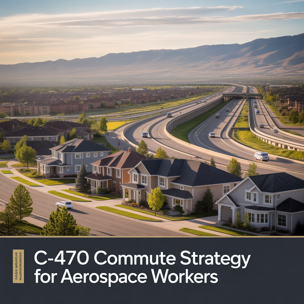
C-470 Commuting Strategy For South Denver Aerospace Workers
This is part of Lockheed Martin Relocation → [Lockheed Martin Relocation Hub] & the larger Denver Relocation Hub → [Denver Relocation Hub] Written by: Chad Cabalka If you work at Waterton, split time between Waterton and the DTC, or live anywhere in the south metro with a Lockheed Martin paycheck attached to it, C-470 is the corridor…