


This is part of Castle Rock Lifestyle Guide → [Castle Rock Lifestyle Hub] & Castle Rock Real Estate Guide → [Castle Rock Real Estate Guide]
Written by: Chad Cabalka
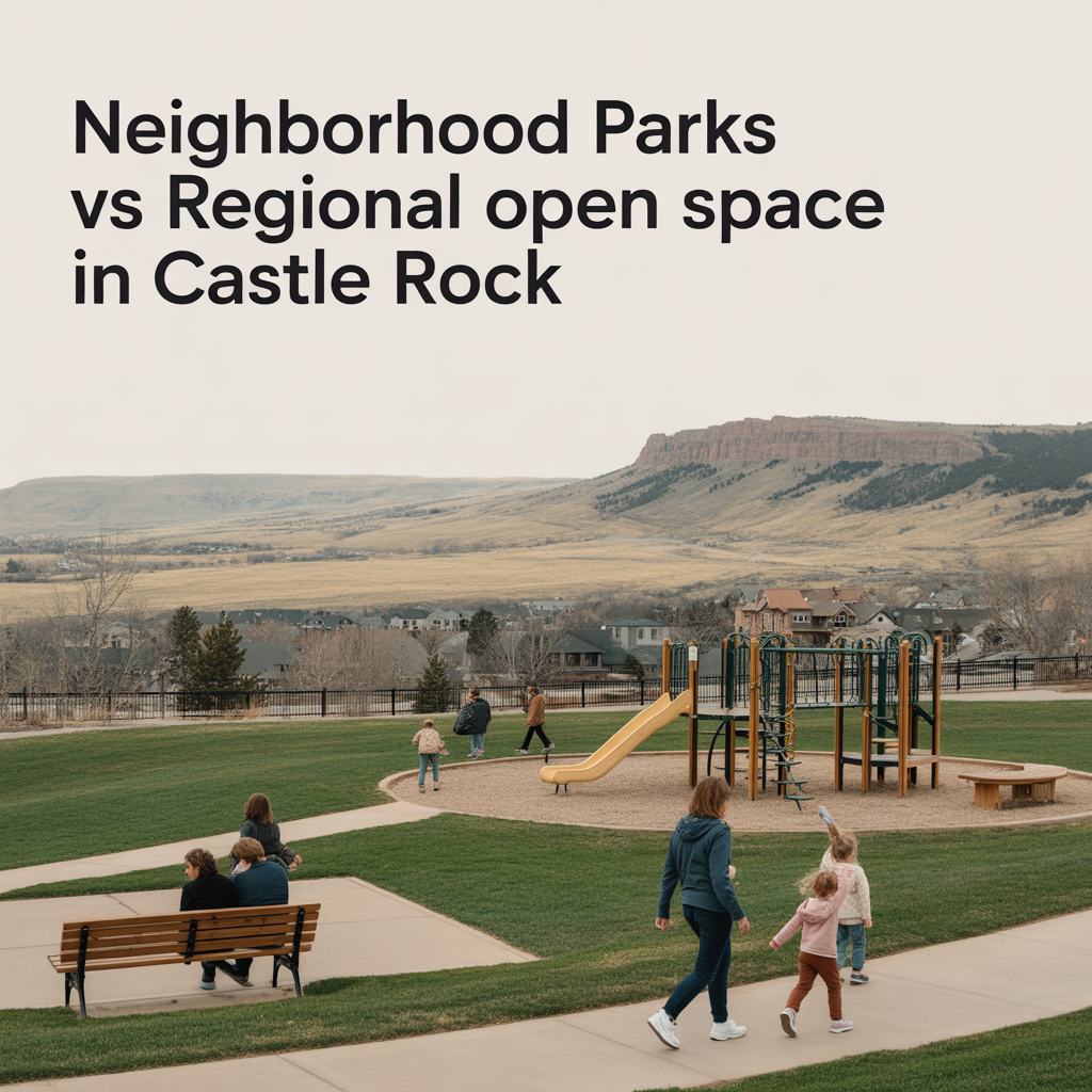
Castle Rock really gives you two different kinds of “green space experiences”: neighborhood parks that feel like your extended front yard, and regional open spaces that feel like you slipped out to the foothills without leaving town. Both matter, but they serve very different roles in daily life and in how a neighborhood feels over time.
What Counts as a Neighborhood Park
Neighborhood parks are the smaller, close‑in spaces tucked into subdivisions — places like Butterfield Park and Paintbrush Park in The Meadows, Cobblestone Ranch Park in the northeast, and similar pocket and community parks in Founders, Terrain, and Crystal Valley. They usually sit within walking or short biking distance of most homes and are deliberately designed around everyday use: playgrounds, turf or multi‑use fields, picnic shelters, and sometimes courts or small splash features.
In The Meadows alone, over 1,100 acres are set aside for parks, trails, and open space, with neighborhood parks like Bison Park offering tennis courts, fields, and play areas that function as daily gathering points. Cobblestone Ranch Park is a good example on the east side: a 12‑acre developed park inside a larger 168‑acre open space area, designed with play zones for different ages, sports courts, turf, and native landscaping that ties into the surrounding community.
For residents, neighborhood parks are where:
- Kids learn to ride bikes and play pickup games.
- Parents meet other families at the playground or fields.
- You can squeeze in a quick walk, throw a ball, or sit outside without planning a “trip.”
The town’s strategic goal to “maintain walkable access to neighborhood parks” shows how central these are to everyday quality of life.
What Regional Open Space Looks Like in Castle Rock
Regional open spaces are the larger, more natural areas that frame the town — places like Ridgeline Open Space, Philip S. Miller Park’s extensive trail network, and the broader open space systems that connect to the Colorado Front Range Trail.
Castle Rock has roughly 6,900 acres of open space, with about 30% of the town designated as open space overall. Those acres include ridgelines, canyons, riparian corridors, and native shrublands that are preserved more for conservation and recreation than for playgrounds and ballfields. Examples include:
- Ridgeline Open Space – About 367–370 acres above The Meadows and Red Hawk, with roughly 13 miles of soft‑surface trails for hiking, trail running, and mountain biking.
- The larger Cobblestone Ranch open space – A 168‑acre area around the 12‑acre developed park, integrated into the Cherry Creek corridor and Colorado Front Range Trail.
- Town‑wide corridors like East Plum Creek and Sellars Gulch – Greenways that double as habitat and trail routes through the middle of town.
Regional open spaces are where you go for:
- Longer hikes, runs, and bike rides with some elevation.
- Big views of the Front Range and the Rock.
- A sense of “being out in nature” even if you’re five minutes from home.
They’re also central to the town’s conservation work, from managing wildlife habitat to dealing with flood corridors and water‑wise land management.
How Residents Use Neighborhood Parks Day to Day
For most households, neighborhood parks are part of the weekly routine, not a special event.
You see:
- Morning stroller walks and dog walks before work.
- After‑school playground trips, especially in The Meadows where trails literally connect homes to parks, schools, pools, and friends.
- Evening and weekend team practices on small fields or courts.
- HOA and community events, like “Music in The Meadows” and neighborhood festivals at places like The Grange or Taft House.
In The Meadows, for example, the trail network ties Butterfield Park, Bison Park, The Grange, Taft House, and schools into one continuous system, so kids and adults can move between parks without driving. On the east side, Cobblestone Ranch Park’s design intentionally links playgrounds, courts, and fields with native plantings and trail connections so residents can use it for everything from casual play to community races and events.
Because these parks are so close, they end up being the “front porch” of the neighborhood: people recognize each other’s kids, dogs, and routines.
How Residents Use Regional Open Space
Regional open spaces, by contrast, feel more like your “in‑town foothills.”
At Ridgeline, residents:
- Run 3–9 mile loops before or after work.
- Mountain bike singletrack without loading bikes onto the car.
- Take sunset walks with skyline views of Longs Peak, Mt. Evans, and Pikes Peak on clear days.
At Philip S. Miller Park and the surrounding open space, they:
- Combine trail time with a stop at the MAC (indoor pool, fields, and family recreation).
- Use long stair climbs and loop trails as serious training for bigger mountain adventures.
- Attend town‑wide events and races that use the open space as a backdrop.
On the east and south sides, regional open space along Cherry Creek and East Plum Creek ties into the Colorado Front Range Trail, giving residents in Cobblestone Ranch, Terrain, and Crystal Valley longer‑distance bike and hike options right from their side of town.
These spaces are where locals go when they want time outside to really reset, not just a quick 20‑minute playground stop.
Planning Priorities: How the Town Sees the Difference
The town’s current Parks and Recreation planning documents make the distinction clear in their priorities:
- Neighborhood focus – Maintain walkable access to neighborhood parks so every resident has a close‑in, everyday space.
- Open space focus – Preserve and expand natural open space resources and strengthen trail and open space connectivity so those larger systems keep pace with growth.
- Regional facilities – Develop unique, regionally significant recreation facilities (like Philip S. Miller Park and the MAC) that anchor the town’s reputation and serve the broader region.
Cobblestone Ranch Park is a good example of how these priorities meet: Phase 1 created a 12‑acre neighborhood park with inclusive play and sports options, but it sits inside a 168‑acre open space master plan tied into regional trails and native ecology. That kind of hybrid design is increasingly where Castle Rock is headed.
What This Means for How Different Areas “Feel”
When you’re looking at Castle Rock neighborhoods through this lens, you can almost categorize them by which kind of green space dominates their daily life:
- Park‑centric feel – Areas with lots of pocket and community parks and shorter trails (parts of The Meadows, Founders, Terrain’s interior parks) feel very “family neighborhood”: frequent playground time, short dog walks, ballfields, and HOA events as the main pattern.
- Open‑space‑centric feel – Areas that back directly to ridgelines, canyons, or creek corridors (Red Hawk and The Meadows near Ridgeline, Cobblestone Ranch near Cherry Creek, Crystal Valley backing open hills) feel more like you’re living at the edge of town even though you’re still in it.
- Hybrid feel – Places that have a strong neighborhood park plus easy reach to a regional open space (The Meadows with Butterfield/Bison + Ridgeline, Cobblestone Ranch Park + its 168‑acre open space, southern neighborhoods that plug into East Plum Creek Trail) give you both: easy kid‑friendly spaces and quick access to “real trail” experiences.
When I’m helping people think about where to live in Castle Rock, this is often the real decision:
- Do you want to walk out the door and land at a playground and field in 3–5 minutes?
- Or do you want to walk out the door and land on a trail with views and wildlife in 3–5 minutes?
- Or do you want to be in one of the pockets where you can reasonably have both?
Once you answer that honestly, the map narrows itself in a way that has nothing to do with builder names or floor plans and everything to do with how your days and weekends will actually feel.
Get the full Denver Market Insights → [Market Insights]


Aurora Southlands Living For Aerospace And Defense Families
This is part of Lockheed Martin Relocation → [Lockheed Martin Relocation Hub] & the larger Denver Relocation Hub → [Denver Relocation Hub] Written by: Chad Cabalka Relocating to Denver for Lockheed Martin changes the home search fast, because Waterton Canyon is not the kind of campus you casually “figure out later.” The southwest metro drives the whole…
Best Neighborhoods For Buckley Space Force Base Commuters
This is part of Lockheed Martin Relocation → [Lockheed Martin Relocation Hub] & the larger Denver Relocation Hub → [Denver Relocation Hub] Written by: Chad Cabalka If Buckley Space Force Base is the anchor of your move, the best neighborhoods are usually in east and southeast Aurora, with the strongest practical options around Southlands, Murphy Creek, East…
C-470 Commuting Strategy For South Denver Aerospace Workers
This is part of Lockheed Martin Relocation → [Lockheed Martin Relocation Hub] & the larger Denver Relocation Hub → [Denver Relocation Hub] Written by: Chad Cabalka If you work at Waterton, split time between Waterton and the DTC, or live anywhere in the south metro with a Lockheed Martin paycheck attached to it, C-470 is the corridor…