


This is part of Centennial Lifestyle Guide → [Centennial Lifestyle Hub] & Centennial Real Estate Guide → [Centennial Real Estate Guide]
Written by: Chad Cabalka
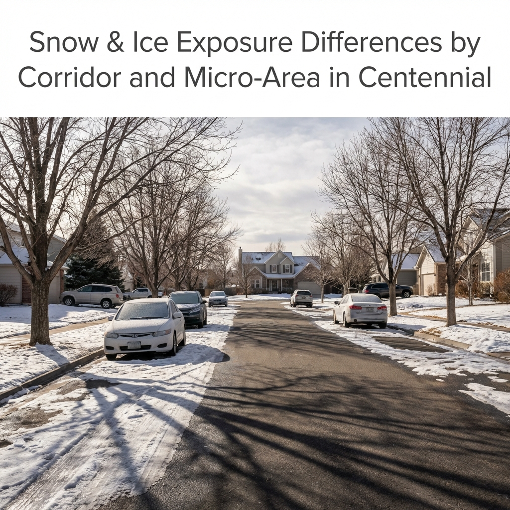
Centennial’s snow and ice feel different depending on which corridor you live near, what your elevation is, and how your streets are prioritized for plowing and de‑icing. Those micro‑differences are subtle on listing sheets but very real at 6:45 a.m. on a school day.
Baseline Snow, Elevation and Climate
Centennial sits around 5,800–6,000 feet, with design ground snow loads around 40 pounds per square foot in structural guidance, similar to other Front Range suburbs at that elevation. Typical winter days see highs in the 40s, overnight lows below freezing, and a mix of dry pavement, freeze–thaw cycles, and periodic storms that drop a few inches at a time, with bigger events scattered through the season.
Because the city spreads across rolling terrain with small elevation changes and open exposure in some areas, the same storm can leave bare pavement in one pocket and persistent ice in another. South‑ and east‑facing slopes tend to melt faster; north‑shaded cul‑de‑sacs and streets that sit in draws hold snow and black ice longer.
Plow Priority and Big‑Road vs Interior‑Street Experience
The most important “exposure” difference is plow priority. Centennial’s snow and ice control plan divides streets into three tiers:
- Priority 1: Major arterials and key collectors (Arapahoe, County Line, Smoky Hill, Dry Creek, Quebec, etc.). These are plowed and treated for all storms, day and night, to maintain emergency and commuter access.
- Priority 2: Important neighborhood collectors and routes to schools and public facilities. These are plowed in most storms and when accumulations pass specific thresholds.
- Priority 3: Local residential streets and cul‑de‑sacs, which are plowed only in heavier events or after the higher‑priority routes are cleared.
If you live backing or very close to a Priority 1 or 2 corridor, your driving surface clears quickly, even in moderate storms. You may listen to neighbors elsewhere talk about being “snowed in” while your main route is wet by midday. In deep interior pockets served only by Priority 3 streets, you can face packed snow and ice for days after a storm, especially if HOA or metro‑district plowing is minimal.
Corridor‑Level Differences: North–South and East–West
Centennial’s main corridors each have their own winter personality:
- I‑25/County Line/DTC edge:
These routes are high‑priority for both the city and state; they get plowed early and often. The trade‑off is volume: more traffic and shade from buildings can polish snow into hardpack or black ice at ramps and intersections, especially at County Line and Dry Creek. - Smoky Hill / East‑side arterials:
East‑side roads sit more exposed on the Palmer Divide’s gentle slope toward the plains. Wind can drift light, powdery snow across lanes and refreeze melted slush into long icy patches overnight. Those corridors are still plowed early, but you feel more blowing snow and open‑field wind chills walking from car to door. - Arapahoe / central corridors:
These are heavily plowed and treated, but constant signalized intersections mean frequent stop‑and‑go. Meltwater from medians and driveways runs into crosswalks and curb lanes, refreezing overnight and creating recurring morning ice in the same spots.
Residents who rely primarily on arterials and freeways get faster clearance but more “hidden” ice at turn lanes, ramp merges, and shaded overpasses; those who spend more time on interior collectors feel fewer drifts and high‑speed splash but more lingering packed snow.
Micro‑Area and Orientation: How Your Block Actually Feels
Even within the same corridor catchment, micro‑area differences matter:
- North‑facing vs south‑facing homes:
North‑facing driveways and sidewalks in Centennial can stay snow‑covered and icy for days longer after each storm, while south‑facing driveways often melt dry a day or two after sun returns, even in January. Over a winter, that difference becomes dozens of shoveling sessions vs a handful. - Cul‑de‑sacs and pockets:
Cul‑de‑sacs with limited sun and no through‑traffic see the slowest melt. The plow often leaves a snow berm at the bulb, and repeated driving compacts snow into rutted ice, which may last until a real warm‑up or a second storm reshapes the surface. - Open‑exposure vs tree‑sheltered streets:
Streets along open space or at higher local points see more wind scouring and drifting; some sections blow nearly bare while others fill with drifts across one lane. Tree‑lined older neighborhoods reduce wind but also shade pavement, slowing melt and encouraging black ice at dawn and after sunset. - Near‑park and trail interfaces:
Paths, greenbelts, and park edges can contribute extra cold air and shaded run‑off. Side streets that sit just downhill from these spaces often hang onto edge‑of‑lane ice where refrozen meltwater crosses the pavement.
Practical Implications for Daily Life and Neighborhood Choice
For residents, the net effect shows up in a few very practical ways:
- School‑day mornings:
If your route to school or work jumps quickly onto a Priority 1 arterial, you can usually move at or near posted winter speeds a day after a storm, while friends in more interior pockets take twice as long creeping over rutted snow. - Walkability:
East‑ and north‑facing sidewalks, especially along collectors, may be patchy or icy much of winter, which matters if you rely on walking kids to school or using trails for daily exercise. South‑side of‑street sidewalks and those maintained by engaged HOAs feel usable more often. - Housing maintenance:
Homes in pockets with persistent snowpack see more freeze–thaw on concrete, more ice dams at eaves when roof melt refreezes at cold gutters, and more stress on driveways and steps. Over time, that shows up in spalling, hairline cracking, and the need for earlier concrete and roof attention. - Vehicle needs and habits:
In neighborhoods where local streets stay snow‑packed between storms, residents are more likely to treat winter tires and AWD as non‑negotiable; near main corridors with fast melt, some owners get by on all‑seasons, accepting a rougher experience only on major storm days.
When you’re evaluating different pockets of Centennial, it helps to think in terms of “how many days after a storm will this feel normal again?” rather than just “how much snow falls here?” A house near a Priority 1 route with a south‑facing driveway lives like a milder climate than one tucked in a shaded cul‑de‑sac feeding only local streets, even though the official snowfall totals match.
If you tell me which corridors and micro‑areas you’re focusing on (north/west/south/east Centennial, slope orientation, typical routes), I can help you frame this in buyer‑ or homeowner‑friendly language that explains snow and ice realities without scaring people — just giving them the context to plan and maintain wisely.
Get the full Denver Market Insights → [Market Insights]


Aurora Southlands Living For Aerospace And Defense Families
This is part of Lockheed Martin Relocation → [Lockheed Martin Relocation Hub] & the larger Denver Relocation Hub → [Denver Relocation Hub] Written by: Chad Cabalka Relocating to Denver for Lockheed Martin changes the home search fast, because Waterton Canyon is not the kind of campus you casually “figure out later.” The southwest metro drives the whole…

Best Neighborhoods For Buckley Space Force Base Commuters
This is part of Lockheed Martin Relocation → [Lockheed Martin Relocation Hub] & the larger Denver Relocation Hub → [Denver Relocation Hub] Written by: Chad Cabalka If Buckley Space Force Base is the anchor of your move, the best neighborhoods are usually in east and southeast Aurora, with the strongest practical options around Southlands, Murphy Creek, East…
C-470 Commuting Strategy For South Denver Aerospace Workers
This is part of Lockheed Martin Relocation → [Lockheed Martin Relocation Hub] & the larger Denver Relocation Hub → [Denver Relocation Hub] Written by: Chad Cabalka If you work at Waterton, split time between Waterton and the DTC, or live anywhere in the south metro with a Lockheed Martin paycheck attached to it, C-470 is the corridor…